
The measurement of the world is a subject that has been addressed by great mathematicians since ancient times. For example, Eratosthenes, applying his knowledge of geometry, measured the radius of the Earth (you can read this post). Gauss also spent a lot of time mapping the kingdom of Hanover and triangulating and measuring distances between mountains. Precisely mountains are the subject of this post. How do you measure the height of a mountain? We know that the calculation is made from sea level, an altitude that we take as a basis for establishing the dimension of the mountain. However, we cannot imagine the mathematician or geodesist on duty moving a measuring rod from the base to the top. Today, satellite geopositioning systems (the famous GPS) are used for this purpose, which contain a triangulation system based on more sophisticated but similar techniques to the topographers’ theodolites. These allow the calculation of elevation angles from a given reference point, from which trigonometric formulae are applied to establish the altitude of a mountain. A triangle is determined whose vertices are the base of the mountain, the summit and the point where the theodolite is located. However, theodolites require a certain prior knowledge of the terrain and its coordinates in order to be able to apply these calculations, not to say that they are sophisticated mathematical instruments that are not so easy to use – or to obtain, if we are talking about 200 years ago. How to measure the altitude of Andean mountains when the terrain is not mapped, and there is at most some barometer and thermometer available? This is precisely the problem that Francisco José de Caldas addressed.
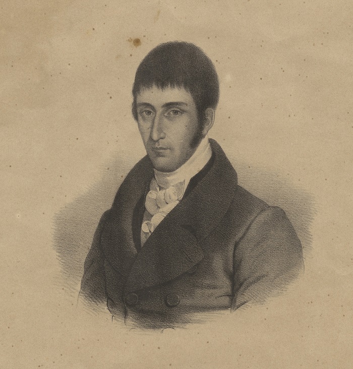 Caldas was a Creole native of the New Kingdom of Granada (now part of present-day Colombia, Ecuador and Venezuela), born into a relatively well established family in the second half of the 18th century. He was trained in jurisprudence, but always had a deep interest in the knowledge of nature and the Enlightenment ideal of quantification of natural phenomena. He was in contact with the famous Celestino Mutis and also met Alexander von Humboldt. Trading on the back of a mule between the Neo-Granadian cities of Asunción de Popayán, Santiago de Cali and San Francisco de Quito, he studied the geology, botany and astronomy of these barely explored lands, measuring and recording everything he saw, and thus ended up exchanging jurisprudence and commerce for mathematics and the observation of nature. On one of his field trips to the Puracé volcano he had the misfortune (or good fortune, as it turned out, providentially) to break one of his precious thermometers, thus proving problematic for the precise temperature measurements he intended to take. Determined to continue his explorations, he soldered the thermometer, filled it with mercury and tried to recalibrate it, as the scale had broken. By immersing the thermometer in snow, he would find the minimum value and by immersing it in boiling water, the maximum value. Then, using a temperature scale (Fahrenheit, Celsius or Réaumur), he could divide the two intervals between the maximum and minimum points. However, he realised that the reconstructed scale did not match the original thermometer scale, so there would have to be a physical cause responsible for the discrepancy. Since he was using ice and boiling water, he first thought that there was some relationship between temperature and latitude, but since he had immersed the thermometer many times before in different places, it could not be that latitude or altitude affected the freezing point. The difference must then be at the top of the scale, which was given by the boiling point. He then thought that atmospheric pressure might influence the temperature at which water boils. Knowing that atmospheric pressure is dependent on altitude, as he had carefully studied Torricelli’s and Pascal’s experiments on the sea of air, he then discovered that, like pressure, the boiling point also varies with altitude, becoming lower as one ascends. And from this idea, he also drew a consequence: it was possible to calculate the altitude of a place without having a barometer, since it would be sufficient to measure the temperature of boiling water. This is what is known as the “thermometric principle of hypsometry”, i.e. a principle that uses temperature to calculate the height of mountains. As one of his biographers explains:
The heat of boiling water is proportional to the atmospheric pressure, the atmospheric pressure is proportional to the height above sea level, the atmospheric pressure follows the same law as the elevations of the barometer, properly speaking, the barometer shows us nothing else than the atmospheric pressure; therefore the heat of water indicates the atmospheric pressure in the same way as the barometer; therefore it can give us the elevations of places without the barometer and with as much certainty as the latter
(L. de Pombo, Francisco José de Caldas, Biografía del sabio, vol II, 15-16.)
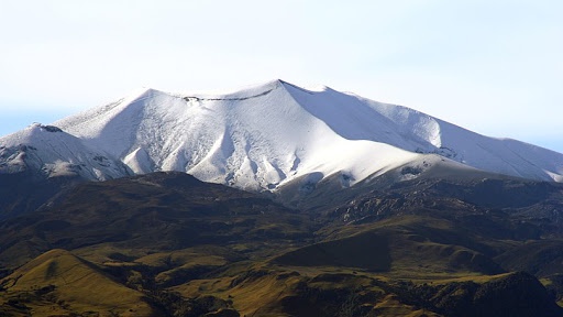
The volcano Puracé
Once he had discovered the principle, poor Caldas racked his brains trying to find out if it had been discovered previously by some European scholar, as the publications to which he had access from the old continent were scarce. He finally published his observations between 1801 and 1809 in four articles dedicated to the thermometric principle of hypsometry and to the measurement of several of the mountains of the Andean region, whose altitude he calculated with an error of less than 1%, these being the first scientific works to be published in the New Kingdom of Granada. The thermometric principle of hypsometry had been postulated by Fahrenheit in 1724 and his experiments were repeated by Jean-André Deluc in 1762, but Caldas was never aware of these publications, as science in New Granada received little from European advances. The usefulness of this principle turned out to be remarkable, for the thermometer is a much simpler and cheaper instrument than the barometer, so that with a very simple method the altitude of different places could be determined quite accurately.
Caldas became a man of science, directing the Royal Astronomical Observatory of San Carlos in Santafé de Bogotá (the first observatory built in America), thus in charge of the astronomical tasks of the Royal Botanical Expedition led by Mutis. However, his life did not end peacefully among investigations, for when in 1810 the Creoles rebelled against the Spanish crown, Caldas participated in the signing of the Act of Independence and was captain of the newly created Republic of New Granada. However, in 1816, Spanish troops reconquered part of the territory and captured several rebels. Caldas was tried and sentenced to death, dying in front of the firing squad on 28 October 1816. The same slogan that circulated in France after the death of Lavoisier is sometimes applied to him: “Spain has no need of wise men”.
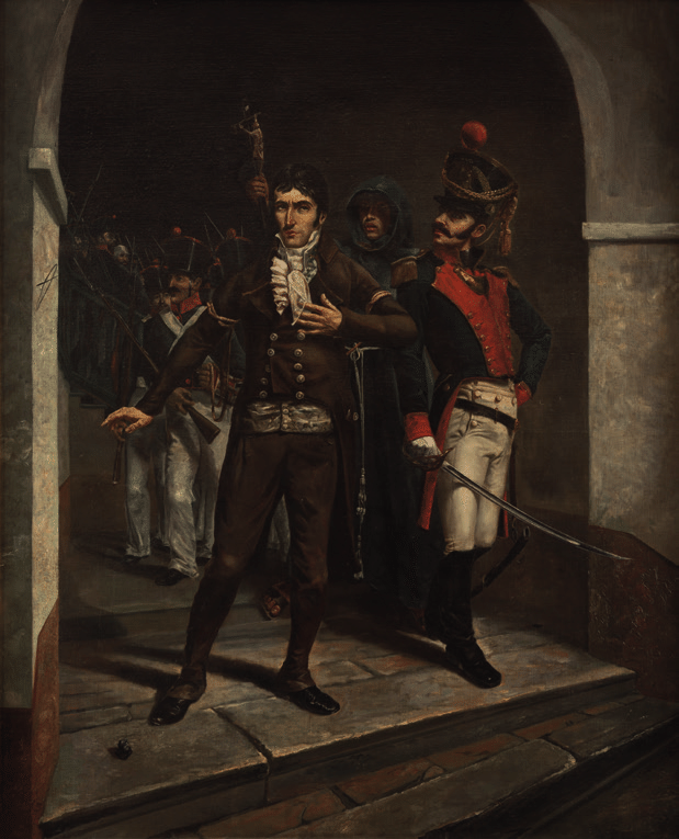 Caldas walks to torture, by Alberto Urdaneta
References
M. Rojas Bernal, Montañas y Medidas. Francisco José de Caldas (1768-116): El descubrimiento del principio termométrico de la hipsometría y el tránsito hacia el sistema métrico decimal. Doctoral thesis presented at the Universitat de Barcelona, 2021.
Leave a Reply